Now you are here: Land Surveying » INSPIRE » Workflow in ZÚ
Workflow in ZÚ
The following picture describes principal databases and subsequent data migration in the process of INSPIRE data sets creation.
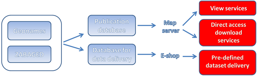
Figure 1: Principal databases and workflow
The digital vector model of the territory of the Czech Republic ZABAGED® (Fundamental Base of Geographic Data) represents a principal source for Transport Networks, Hydrography and Geographical Names themes. Data of Geographical Names theme are also derived from the database of geographic names of the Czech Republic Geonames. Both databases are updated in a three-year cycle with a continual update of selected features. Source dataset for Orthoimagery theme is Orthophoto of the Czech Republic that is updated in two-year cycle. Digital Terrain Model of the Czech Republic – 4th generation (DMR 4G) is a source dataset for covering the raster representation of Elevation theme according to the application scheme Elevation - Grid Coverage. From the more detailed Digital Model of the Czech Republic of the 5th generation (DMR 5G), harmonized data Elevation - application scheme TIN has been derived.
ZABAGED and Geonames data are transformed according to INSPIRE requirements using ETL into a publication database. Data from the publication database are subsequently published through map server as viewing services and direct access download services. Pre-defined data sets are migrated to separate database. In this way data for Hydrography, Geographical Names and Transport Networks themes are published in a half- year cycle.
Raster data sets of Elevation and Orthoimagery themes are transformed separately from the source data. Their update period corresponds with the update of source data sets.